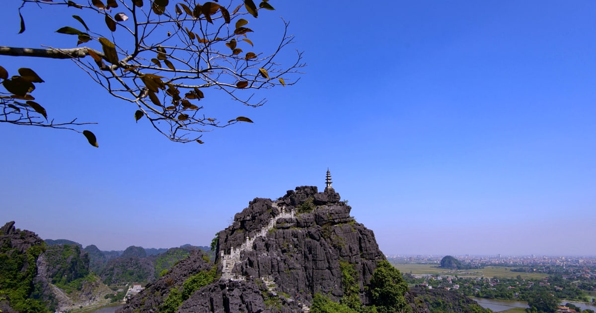
The 486 steps to the summit of Mua Cave are, by any reasonable measure, not a hike. They are a staircase — albeit one with a rather fine view at the top. The genuine ninh binh hiking opportunities lie elsewhere, along limestone ridges and through forested valleys that most visitors never discover because they assume the steps were all there was.
This guide covers seven ninh binh hiking routes ranging from gentle riverside paths to moderately challenging karst terrain, none of which involve queuing behind 300 tourists for a selfie.
At a glance:
- Trails covered: 7 routes, easy to moderate difficulty
- Best season: October–April (dry, cool, 18–25°C)
- Terrain: Limestone karst, river paths, forest trails
- Elevation: Sea level to 400m (highest point: Cuc Phuong ridge)
- Equipment: Sturdy shoes required — no flip-flops (limestone is sharp)
Cuc Phuong National Park — Serious Forest Hiking
Cuc Phuong National Park — Vietnam’s oldest national park, established in 1962 — contains 222 square kilometres of primary tropical forest that supports some of the most rewarding ninh binh hiking available. The park sits 45 kilometres northwest of Ninh Binh city, straddling three provinces.
The precise coordinates are available at navigate to Ninh Binh — useful for those who, like myself, prefer precision over approximation.
The park offers four marked trails:
| Trail | Distance | Time | Difficulty | Highlights |
|---|---|---|---|---|
| Prehistoric Cave Trail | 3 km return | 1.5h | Easy | Cave with Neolithic-era artifacts |
| Ancient Tree Trail | 5 km loop | 2.5h | Moderate | 1,000-year-old Parashorea tree |
| Muong Village Trail | 8 km one-way | 4h | Moderate | Ethnic Muong community, valley views |
| Silverback Ridge | 12 km return | 6h | Challenging | Langur habitat, karst panorama |
📚 Historical Note: During the American War, Cuc Phuong served as an evacuation site for Hanoi’s university collections. Students carried thousands of museum specimens into the forest caves in 1967 — some of which remained hidden until the 1990s restoration effort.
Entry fee: 100,000 VND ($4). Guide hire (recommended for Muong Village and Silverback): 500,000 VND ($20) per group. The Endangered Primate Rescue Centre at the park entrance warrants a stop — it houses captive-breeding programmes for several langur species found nowhere else on earth.
Trang An Eco-Route Hiking Trail
The lesser-known hiking component of the Trang An complex follows a 4-kilometre elevated path along limestone ridges between boat stations. Most visitors take the boat-only circuit and miss this entirely — which, from a crowd-avoidance perspective, suits hikers rather well.
The trail involves approximately 200 metres of elevation gain across uneven limestone steps. Views from the ridgetop extend across the entire Trang An valley — a perspective that the boat tour, by definition, cannot provide. The descent connects to boat station 3, allowing a boat-hike-boat combination that remains the most comprehensive way to experience the UNESCO site.
Difficulty: Moderate. Time: 1.5 hours for the hiking section. No additional fee beyond the standard Trang An entrance (250,000 VND).
Van Long Nature Reserve — Flat Wetland Walks
For those who prefer their ninh binh hiking horizontal rather than vertical, Van Long offers 6 kilometres of elevated dyke paths through wetland terrain. The paths follow the perimeter of the reserve, offering views across still water channels to vertical karst walls.
The appeal here is ornithological rather than athletic. Early morning walks (before 7:00 AM) along the eastern dyke regularly produce sightings of grey herons, painted storks, and — if patience and luck conspire — the Delacour’s langur on the distant cliff faces. Binoculars are not optional; they are essential.
Difficulty: Easy. Distance: 6 km total (various loops). Time: 2–3 hours. Free access to dyke paths; boat tours separate (90,000 VND).
Bai Dinh to Trang An Forest Path
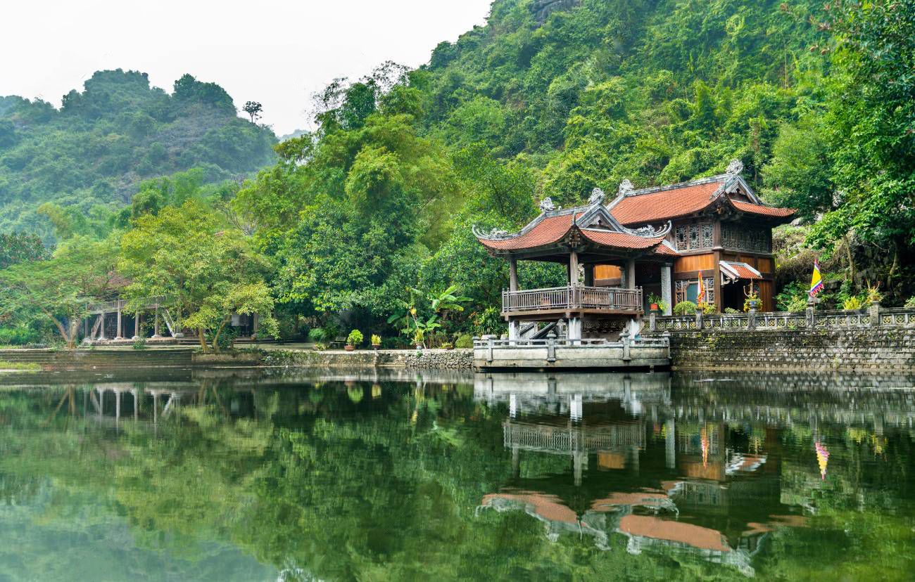
A 5-kilometre connecting path through secondary forest links the Bai Dinh Pagoda complex to the Trang An boat wharf. Few tourists use it — most take the road by car — but the trail passes through bamboo groves and along a small stream that provides a welcome counterpoint to the rather overwhelming scale of Bai Dinh’s architecture.
The path is poorly marked in sections. A downloaded offline map (Maps.me or Google Maps with offline area) is strongly recommended. The trail involves no significant elevation change and can be walked in standard trainers.
Difficulty: Easy. Time: 1.5 hours. No entrance fee for the trail itself.
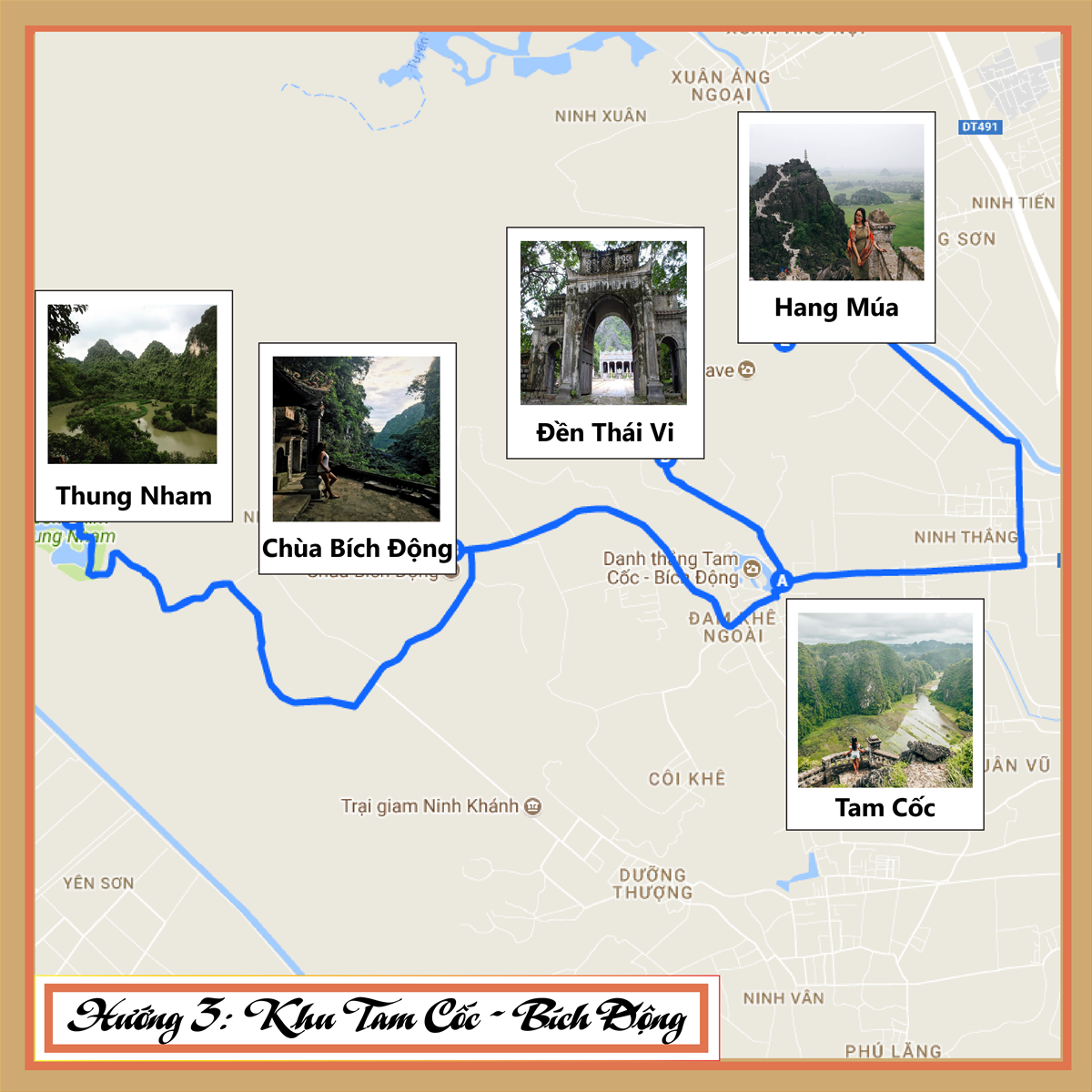
Tam Coc – Bich Dong Circuit
The 7-kilometre cycling/walking circuit connecting Tam Coc wharf to Bich Dong Pagoda follows a paved lane through rice paddies that functions equally well on foot. The section between kilometres 3 and 5, where the path narrows between karst walls and flooded fields, produces the landscape that made Ninh Binh famous — and walking it, rather than cycling past at speed, allows proper appreciation of the scale.
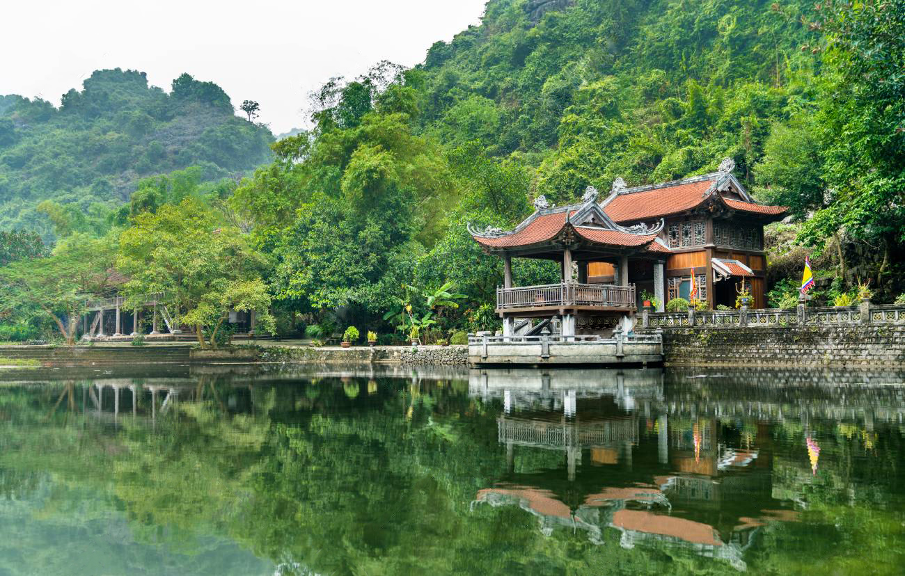
The route passes Thai Vi Temple (11th century), several family-run rice wine stalls (sampling is encouraged; purchasing is appreciated), and the entrance to Bich Dong — the “second most beautiful grotto of Vietnam” according to a scholar who visited in 1773 and whose opinion has not been seriously contested since.
Difficulty: Easy. Time: 2.5 hours one-way walking. Best combined with a Tam Coc boat tour in the morning and the walk in the afternoon.
Hang Mua (Mua Cave) Extended Ridge
Yes, the 486 steps are indeed just a staircase. But beyond the famous viewpoint at the summit, a continuation trail follows the limestone ridge for an additional 2 kilometres to the south. This unmarked extension — reached by turning right at the dragon statue instead of stopping for photographs — offers views equal to the main summit without any other visitors.
The ridge path is narrow, uneven, and involves some scrambling over limestone outcrops. Not suitable for those uncomfortable with exposure. Excellent at sunset, when the light across the Tam Coc valley turns the rice paddies from green to gold.
Difficulty: Moderate to challenging. Time: 45 minutes beyond the summit. Entrance: included in Mua Cave ticket (100,000 VND).
What to Bring for Ninh Binh Hiking
- Footwear: Sturdy shoes with grip. Limestone is sharp and slippery when wet. Sandals are asking for trouble.
- Water: Minimum 2 litres. There are no water sources on most trails.
- Sun protection: Hat, sunscreen SPF 50+. Karst terrain reflects heat aggressively.
- Rain gear: Lightweight poncho October–April. Full waterproof layer May–September.
- Navigation: Downloaded offline maps. Trail marking ranges from adequate (Cuc Phuong) to non-existent (Bai Dinh connector).
📌 Book this experience:
the Viator listing | the instant confirmation on Klook
Some links are affiliate links. We earn a small commission at no extra cost to you.
For travelers looking to arrange hiking tours and trekking guides in advance, I have found that you can find guided hiking tours on 12Go with verified operators and instant confirmation.
FAQ
Is Ninh Binh good for hiking?
Yes. Beyond the famous Mua Cave steps, Ninh Binh offers 7+ hiking routes through limestone karst, tropical forest (Cuc Phuong National Park), and wetland terrain (Van Long). Trails range from easy riverside walks to moderate ridge climbs.
What is the best hiking trail in Ninh Binh?
Cuc Phuong National Park’s Ancient Tree Trail (5 km, 2.5 hours) offers the most rewarding forest hiking. For karst scenery, the Trang An Eco-Route ridge trail provides UNESCO-level views with minimal crowds.
Do you need a guide for hiking in Ninh Binh?
Not for most trails. Cuc Phuong’s Muong Village Trail and Silverback Ridge benefit from a local guide (500,000 VND per group). Tam Coc-Bich Dong and Van Long are self-guided. Download offline maps for poorly marked routes.
When is the best time to hike in Ninh Binh?
October through April offers dry weather and comfortable temperatures (18–25°C). May–September brings heat (35°C+) and monsoon rain, making limestone trails slippery. Early morning starts (before 7:00) are essential year-round.
Related Ninh Binh Guides
Disclosure: Some links in this article are affiliate links. If you book through them, we earn a small commission at no extra cost to you.
📍 Explore more: things to do in Ninh Binh →
🏛️ Explore Ninh Binh with Expert Guides — Book a private Ninh Binh tour with knowledgeable local guides who bring the UNESCO heritage to life. All-inclusive day trips from Hanoi starting at $45/person.
For further reading: the Trang An landscape Wikipedia entry.
Frequently Asked Questions
What are the most rewarding hiking trails in Ninh Binh?
The Mua Cave summit trail (500 stone steps, 20 minutes) delivers the province’s most celebrated panoramic view for minimal effort, while the Cuc Phuong National Park circuit offers 18 kilometers of jungle trails through one of Asia’s oldest limestone forests. For intermediate hikers, the trail connecting Bich Dong Pagoda to Thung Nham traverses 7 kilometers of karst terrain with minimal tourist traffic.
Is Ninh Binh hiking suitable during the rainy season?
The monsoon months of July through September bring afternoon downpours that render steep limestone trails — particularly the Mua Cave steps — quite slippery, requiring proper footwear with grip soles. However, the rainy season also fills the rice paddies to their most photogenic levels and reduces visitor numbers by approximately 40 percent, creating a trade-off experienced hikers may find worthwhile.
Do I need a guide for hiking in Ninh Binh?
The Mua Cave and Bich Dong trails are well-marked and independently navigable, but Cuc Phuong National Park’s deeper trails benefit from a park guide (200,000 VND per group) who can identify endemic species including the endangered Delacour’s langur. Village-to-village routes through the karst valleys lack signage entirely and require local navigation.